Case study · Street analysis
BlossomEdge Go-Bike — near-miss data analysis · 17 July 2026
Prompted by the temporary bus-lane decision of July 2026.
From late July 2026, the City of Munich plans to displace cyclists from the new protected cycle lane on Lindwurmstraße (Reisingerstraße → Sendlinger Tor, inbound) onto the old sidewalk-level layout, to create a temporary bus lane for U-Bahn rail replacement services — initially until Oktoberfest.
We analysed 124 individually video-verified near-misses from June–July 2026 and the official cyclist-accident record to quantify what this decision trades away. The result is unambiguous: the protected lane is the single demonstrated safety success on this street — near-miss density on the protected stretch is one third of the directly adjacent unprotected stretch, on a street where the pre-lane accident record shows both stretches were equally dangerous.
Reversing it, for months, during a period when the U-Bahn closure is pushing more people onto bicycles, must be expected to produce additional cyclist accidents — including serious injuries. In plain terms: if near-miss data predicts accidents — and in our data it does — this decision will hurt people.
The same analysis surfaced two secondary findings about the construction programme itself: the most dangerous stretch of the street (Section 2) has no construction start date, and the programme prioritises the street's quietest stretch (Section 3) over an unplanned stretch (Aberlestraße → Pfeuferstraße) that out-scores it on every risk indicator.
The U3/U6 closure between Sendlinger-Tor-Platz and Implerstraße (approx. one year) has brought rail-replacement buses (SEV) and congestion to Lindwurmstraße. In July 2026 the Mobilitätsreferat and MVG announced a temporary bus lane on the new protected cycle lane, relocating bicycle traffic to the old sidewalk-level path — the layout the Radentscheid rebuild had just replaced. The ADFC calls this a dangerous step backwards on one of Munich's most-used cycle routes.
This document quantifies the safety stakes of that decision using ride data recorded on this street after the lane opened — evidence that did not exist when the decision was made.
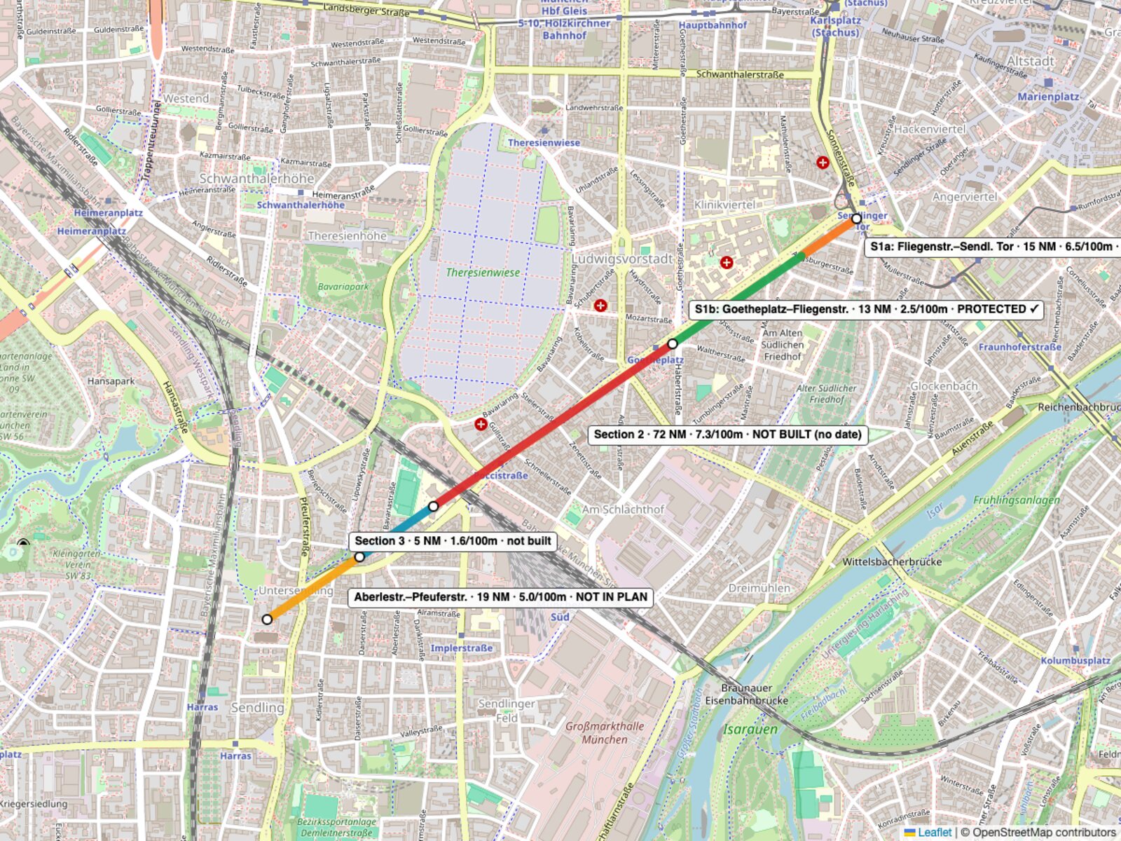
The Lindwurmstraße redesign (Radentscheid measure, city-council mandate 2019) is planned in three sections. Only Section 1 (Sendlinger-Tor-Platz → Goetheplatz) exists: built August–September 2025, in use since mid-September 2025 — a roadway-level cycle lane up to 3 m wide, physically protected by bollards, with the old sidewalk-level path returned to pedestrians. Section 2 (Goetheplatz → railway overpass) and Section 3 (railway overpass → Aberlestraße) are unbuilt, without start dates, at an estimated €16–18 million each. The final stretch, Aberlestraße → Pfeuferstraße, appears in no published section.
Evidence base: verified near-misses are detected automatically by the Go-Bike app during rides and individually confirmed by a human on video (June–July 2026 — i.e. recorded on the street as it is today, with Section 1 in operation). Accidents are official Unfallatlas cyclist records (from 2024), which essentially predate the lane. The combination enables a before/after comparison that neither dataset provides alone.
| Official section | Stretch | Length | Near-misses | Accidents | NM / 100 m | Acc / 100 m | Lane planned | Implemented |
|---|---|---|---|---|---|---|---|---|
| Section 1 | Fliegenstr. → Sendlinger Tor | 230 m | 15 | 5 | 6.5 | 2.2 | Yes | Sept 2025 — protected |
| Section 1 | Goetheplatz → Fliegenstr. | 530 m | 13 | 6 | 2.5 | 1.1 | Yes | Sept 2025 — protected |
| Section 2 | Goetheplatz → Eisenbahnüberführung | 985 m | 72 | 16 | 7.3 | 1.6 | Yes | No — no start date |
| Section 3 | Eisenbahnüberführung → Aberlestr. | 305 m | 5 | 0 | 1.6 | 0.0 | Yes | No — no start date |
| — | Aberlestr. → Pfeuferstr. | 380 m | 19 | 3 | 5.0 | 0.8 | Not in plan | No |
| Total | Lindwurmstraße | 2,430 m | 124 | 30 | 5.1 | 1.2 |
Verified near-miss density by stretch
Near-misses per 100 m, June–July 2026. Stretches in geographic order, north to south — so directly adjacent stretches sit next to each other.
Before the lane — recorded accidents
Cyclist accidents per 100 m (Unfallatlas, essentially pre-lane). The two adjacent stretches are statistically indistinguishable.
After the lane — verified near-misses
Near-misses per 100 m on the same two stretches, June–July 2026. The gap opens exactly where the infrastructure changed.
Note the two charts have different units and different scales — they are deliberately shown as separate panels, never on shared axes.
The street itself provides a controlled comparison: two directly adjacent mid-block stretches, ridden by the same cyclists in the same weeks, differing only in infrastructure. The protected stretch (Goetheplatz → Fliegenstraße) runs at 2.5 verified near-misses per 100 m. The unprotected Section 2, immediately across Goetheplatz, runs at 7.3 — a factor of 2.9.
The official accident record — which predates the lane — shows no such gap: 1.1 vs 1.6 cyclist accidents per 100 m, statistically indistinguishable at these counts. Before the lane, the two stretches were comparably dangerous; after it, their near-miss densities differ by a factor of three, in favour of the protected stretch. The safety difference appears exactly where and exactly when the infrastructure changed. This is as close to a controlled before/after experiment as street data allows.
Using near-misses as a leading indicator of accidents is standard safety practice (the well-known incident pyramid: many near-misses precede each injury). Our data supports the assumption on this very street: ranking the stretches by near-miss density reproduces the ranking of the official accident record wherever the infrastructure has not changed. Where the two datasets diverge — the protected stretch — is precisely where the infrastructure did change, in the direction the lane was built to achieve.
The temporary bus lane returns cyclists to the sidewalk-level layout — the configuration under which this street produced its recorded accident history, including serious injuries. Based on the measured contrast, near-miss density on the affected stretch must be expected to rise towards the unprotected level — roughly a threefold increase — for the months the measure lasts.
It does so at the worst possible moment: the U-Bahn closure is moving more people onto bicycles on one of Munich's most-used cycling corridors, so more riders are exposed to the higher risk. Accepting the incident-pyramid relationship between near-misses and accidents, the arithmetic is unavoidable: a months-long, threefold increase in near-miss density at increased ridership means additional cyclist accidents — among them, statistically, serious injuries, or worse.
The near-miss videos on the protected stretch show that most of its remaining incidents occur where the lane is interrupted — an active construction zone and illegally parked cars that force riders into mixed traffic. Interruptions, not the lane, generate the residual risk (which also means the true protected-vs-unprotected contrast is larger than the reported factor of three). The temporary bus lane is, functionally, a planned months-long interruption of exactly this kind — applied to the whole stretch at once.
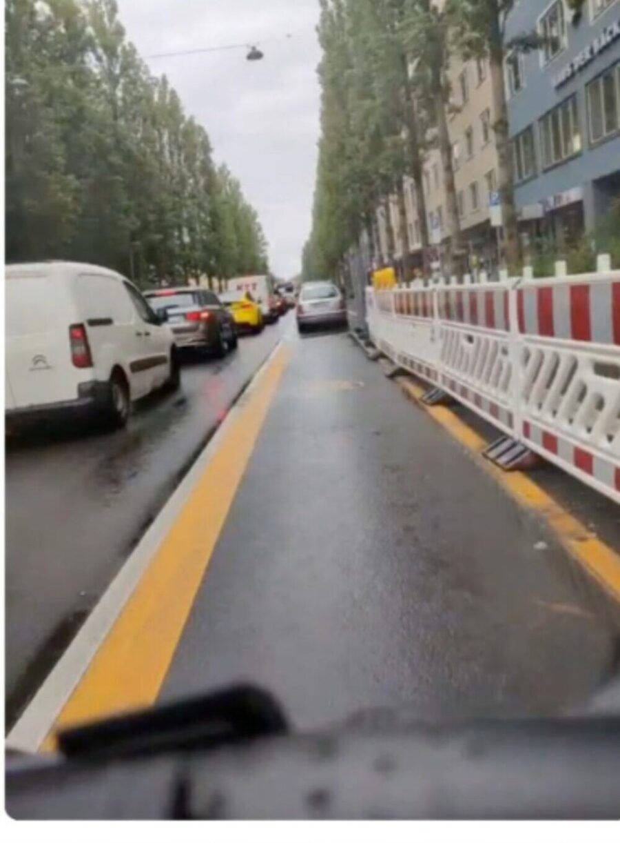
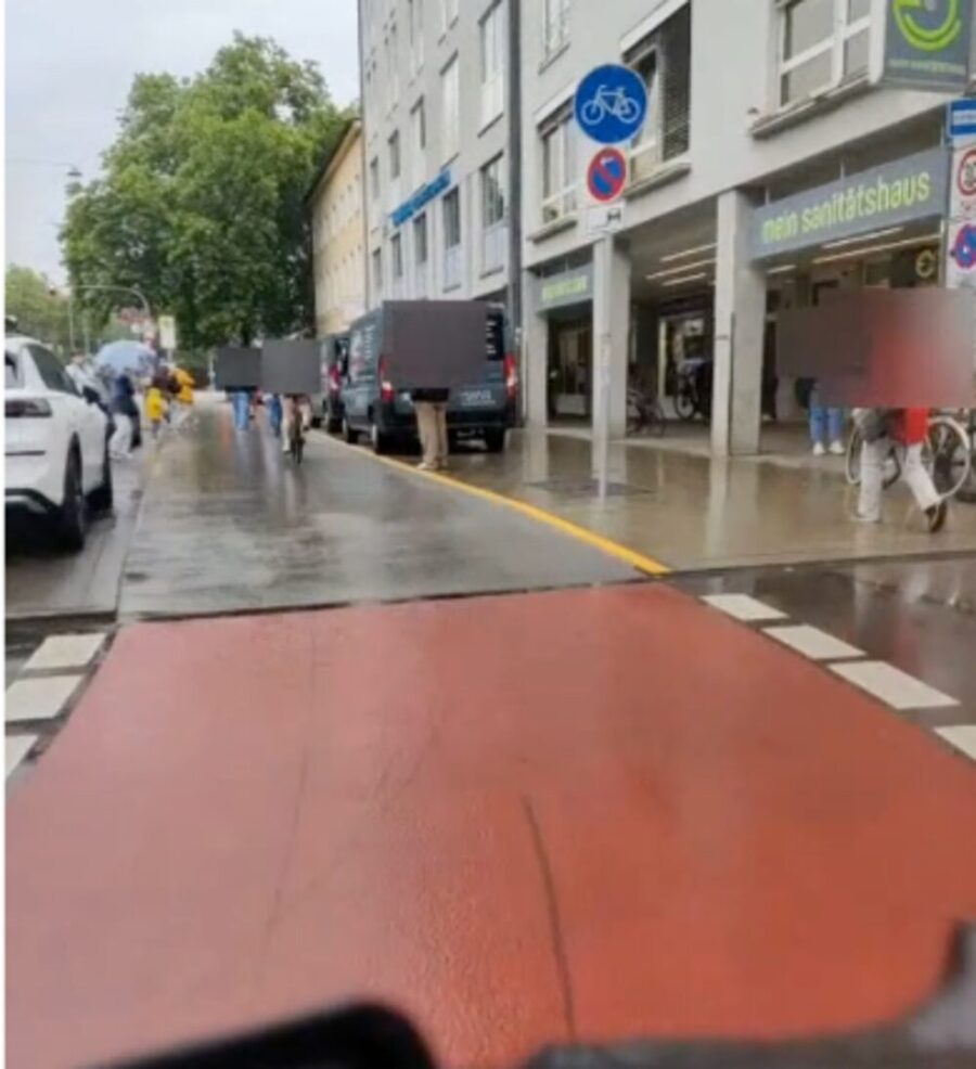
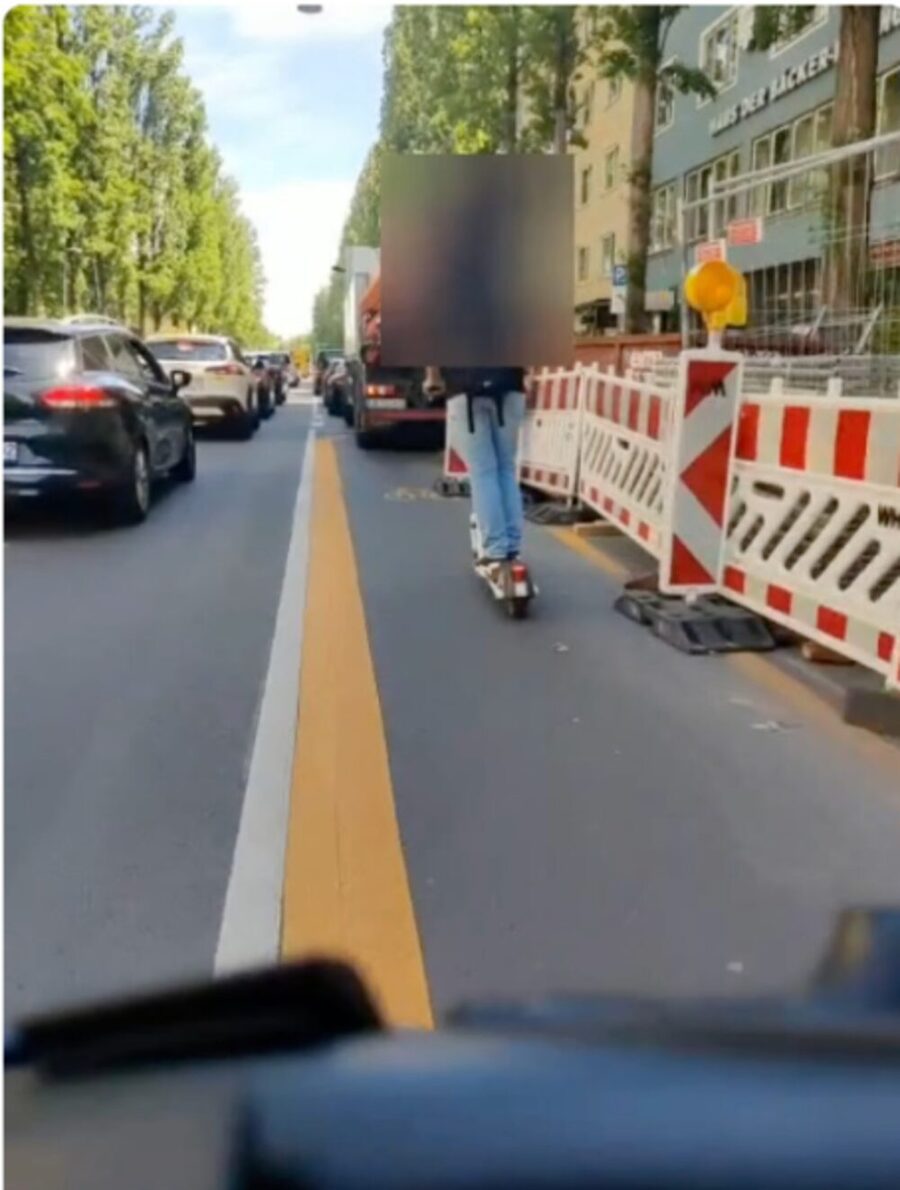
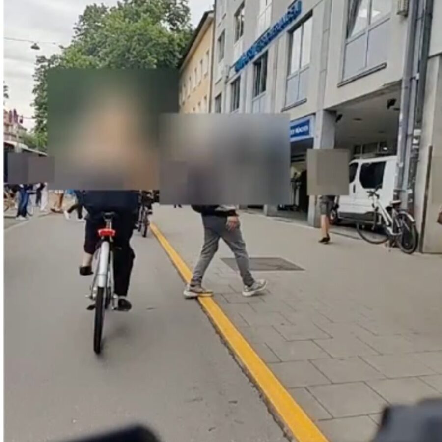
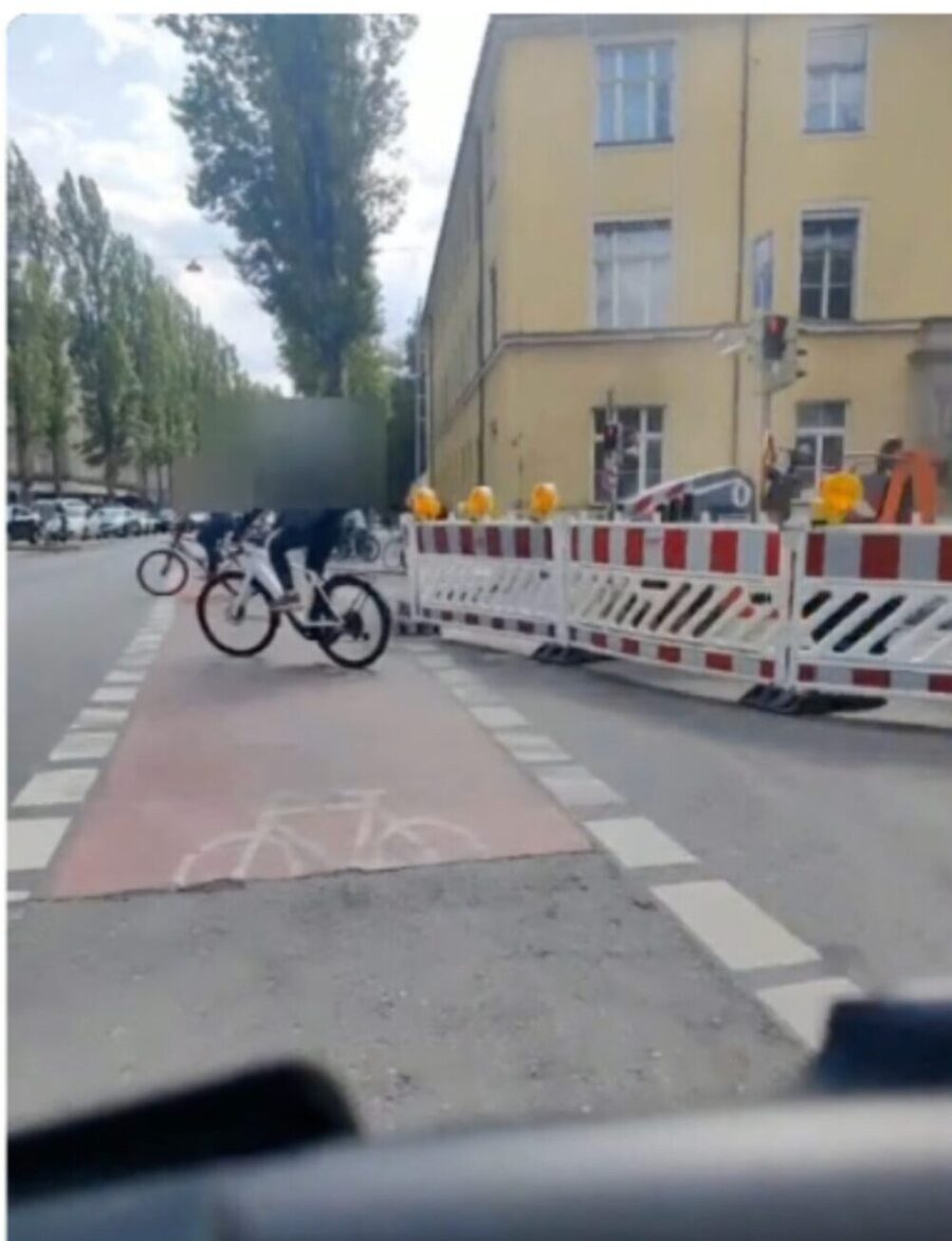

Frames from Go-Bike near-miss recordings on Lindwurmstraße, each automatically detected during a ride and individually confirmed by a human reviewer. Faces and number plates are blurred.
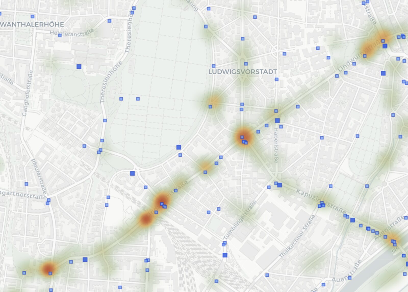
Section 2 carries 72 verified near-misses (58% of the street's 124) and 16 recorded cyclist accidents (53% of 30) in 40% of the street's length — 7.3 near-misses per 100 m, the densest stretch of Lindwurmstraße. It is planned, funded in principle, and has no start date.
Section 3 is the quietest stretch of the entire street on every measure (5 near-misses, 1.6 per 100 m, zero recorded accidents). The unplanned stretch Aberlestraße → Pfeuferstraße out-scores it on every indicator: 19 vs 5 near-misses, 5.0 vs 1.6 per 100 m, 3 vs 0 accidents. The stretch that is not in the programme is measurably more dangerous than the stretch that is.
Within Section 1, the junction approach Fliegenstraße → Sendlinger Tor runs at 6.5 near-misses per 100 m despite the new lane. The videos point to the transition where the roadway-level protected lane ends and returns riders to the sidewalk-level layout — a design discontinuity that concentrates conflicts. Notably, this is the very layout the temporary bus-lane measure would extend to the whole stretch.